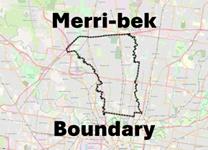
This webpage is about the completed community consultation for the stormwater map in Merri-bek's local drainage areas, where Council is the local drainage authority.
Contact Melbourne Water for any queries about the regional drainage areas in Merri-bek:
Melbourne Water | Flood Information Program
Melbourne Water's other contact details can be found on its webpage.
Regional Drainage (Melbourne Water)
- The bigger underground pipes and their inlet and outlet structures. Sometimes under roads and within properties in our neighbourhoods.
- Associated with the stormwater (flood) map on Melbourne Water's website: Melbourne Water | Main Drainage Stormwater Map
- Regional drains are located inside the mapped area on the Melbourne Water stormwater (flood) map.
- When the capacity of the Melbourne Water regional drain is exceeded, stormwater flows overland. This flow is represented by the Melbourne Water mapped area.
- In some locations the regional drains may be a constructed floodway channel.
- Waterways are also part of Melbourne Water’s regional drainage responsibilities, but will be part of a separate, future update flood mapping by Melbourne Water.
- Repairs and maintenance for regional drains is done by Melbourne Water.
- Any inquiries about regional drains should go to Melbourne Water at: Melbourne Water | Main Drainage Stormwater Map
Local drainage (Council)
- Council manages the smaller drains in our neighbourhoods. These are the ones commonly found under roads.
- Stormwater from the smaller council drains flows into the regional drains. The two systems are connected.
- Within Melbourne Water's stormwater (flood) map, regional drainage dominates, and the stormwater overland flows are associated with the regional drains. Local drainage is less significant.
Council has updated its stormwater map
We wrote to people with land affected by stormwater flows from infrequent but significant storms. We did this because the Victorian Government has a planning process to prepare, share and use stormwater maps.
Council manages the smaller, local drainage areas. Melbourne Water manages the bigger, main drainage areas. The updated map is only for Council's local drainage areas.
What does the map show?
The map shows land affected by stormwater flow paths in a 1 in 100-year storm across Council's drainage catchment area. A 1 in 100 year storm has a one percent chance of happening in any year. The 1 in 100 year storm measure is the engineering and planning standard for preparing stormwater maps.
What is the map for?
The map is for people who want to build on land affected by stormwater flows in 1 in 100 year storm events. Building on land needs a permit, so the map will go into the planning scheme. This is so Council and land developers can ensure that new development considers stormwater flows. The map also helps Council to identify areas for drainage improvements.
Council's updated stormwater map is shown in blue.
To navigate the display:
- First, type the address in the Search Address box at the top-right of the map to find the address on the map.
- The map will then go to the address and an information box for the address will appear.
- If the land at the address is affected by a stormwater map, the information box will tell you.
- If your land is affected you can find out more on the Stormwater map for Council drainage areas page.
Note: The Search widget (top-right) and Legend widget (bottom-left) can be hidden or displayed by click the small button beside each widget.
This map is best seen on a desktop or laptop computer
- If you have neither, consider visiting one of our libraries.
- You can view a full-screen version of our 2025 Stormwater Flood Risk map. When using a mobile device it is best to use the map in the full-screen version.
If you are vision impaired or you are having trouble reading this map, please contact Strategic Planning on 9240 1111.
How will the proposed stormwater map affect new development on your property?


