Our ideas

Below is what we are imagining is possible for the new pocket park.
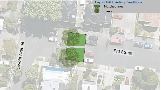
Comparison

Use the slider to compare the current area with the area of the proposed pocket park.
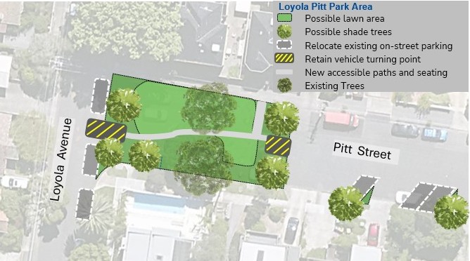
Current area: An aerial map showing the area between Loyola and Pitt Streets. The mulched area is marked with green squares. There are two large trees in the middle of the space and car parks on either side of the mulched area. Proposed park area: An aerial view of the space between Loyola and Pitt Streets. in this image the mulched area, marked by green squares, is much larger. There are new trees at either end of the new space. There are yellow striped markings showing where cars can turn around.

Interactive plan

Refer to the key or click on the spots for more information on the features in the plan.

An aerial view of the space between Loyola and Pitt Streets. The planned lawn area is marked in green. There are markings for new trees, paths and relocated parking spaces.

Your ideas